Das digitale 3D-Stadtmodell
Stuttgart 3D findet vielerorts seinen Einsatz. Denn durch die Visualisierung in 3D werden Einflüsse wie Geländeformen, besonders die in Stuttgart, sowie das Verhältnis von vorhandener zu geplanter Bebauung praxisnah dargestellt.
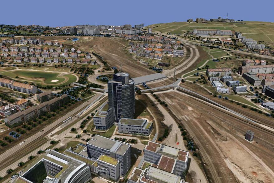
Stuttgart 3D besteht im Einzelnen aus dem Digitalen Geländemodell (DGM), welches auf einer Laserscan-Befliegung basiert sowie aus dem 3D-Gebäudemodell. Die Datenerfassung und -aufbereitung für den Aufbau des 3D-Gebäudemodells basiert auf einer Luftbildauswertung (photogrammetrische Auswertung), die zwischenzeitlich über eine regelmäßige Fortführung der Bestände aktuell gehalten wird. Dabei können die unterschiedlichsten Inhalte (3D-Bestand, Planung, Luftbilder, Pläne, Sachdaten oder Symbole) kombiniert werden. Das ganze Stadtgebiet liegt nicht nur in einer unterschiedlich detaillierten Geometriedarstellung vor, sondern es gibt auch ein volltexturiertes Modell aus Schrägluftbildaufnahmen. Somit erhalten Sie zusätzlich einen fotorealistischen Eindruck der ganzen Stadt.
Der 3D-WebViewer
Mit dem „Stuttgart 3D-WebViewer“ (Öffnet in einem neuen Tab)werden auch hier aktuelle Webtechnologien eingesetzt. Dies erlaubt einen Einsatz in Ihrem aktuellen Browser ohne weitere Vorgaben oder zusätzlicher Software. Durch seine intuitive Navigation bietet der Viewer einen einfachen Zugang zu Informationen aus der 2D oder 3D Geoinformation der Stadt. Mit zusätzlichen Werkzeugen lassen sich die Inhalte exportieren, einen Schattenwurf nach Datum einblenden, den Ausschnitt als URl weiterempfehlen oder einfach einen Screenshot im PDF-Format tätigen.